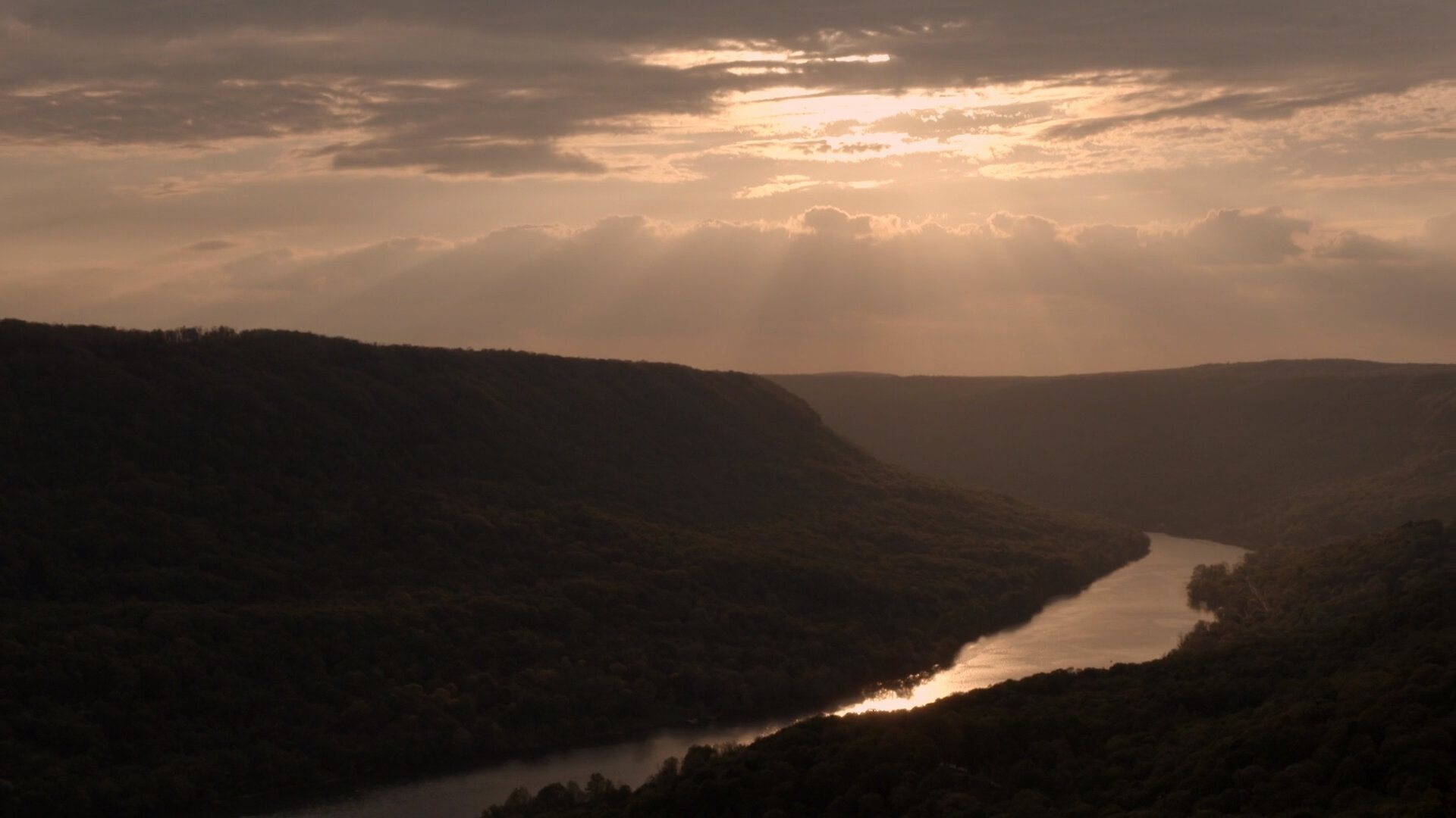

Ready for the journey of a lifetime? Or a lifetime of journeys?
Whether you are planning the hero’s journey of 652 miles, a weekend adventure, or a single day excursion, our interactive planning map will help you locate important locations such as boat launches, carry-ins, campgrounds, parks, and outfitters.
Since 2020, the Tennessee RiverTowns Program and UT Chattanooga have created a detailed inventory of river-related amenities along the Tennessee River. The Tennessee RiverLine interactive web map helps users like paddlers and boaters plan trips by providing information on amenities such as access points, marinas, campgrounds, parks, and outfitters, all within a 15-minute drive from the river.
TRIP RECOMMENDATIONS
Want a suggested itinerary to make your trip planning even easier? These recommended adventures provide experiences for all levels in locations across the 652-mile reach of the Tennessee River. You’ll find restaurants, fun facts about the communities, things to do and attractions to see, nearby outfitters, and what to expect from each paddle experience.
-
MULTI-DAY INTERMEDIATE/ADVANCED PADDLE
Start: Polecat Ramp
End: Tom Fuller Memorial Park
Length: 27.75 miles per USACE river mile markers. Actual distance will vary depending on the visitor’s actual route.
DOWNLOAD OR PRINT THE MAP FOR THIS JOURNEY
Experience: This multi-day Tennessee RiverLine experience explores the scenic landscapes and bustling towns of Roane County, TN. Along the route, visitors will witness the area’s natural beauty with towering limestone bluffs, rolling hills of forests and farmland, and river islands that are home to diverse wildlife. Eagles and osprey will survey your journey from overhead, and herons and egrets stand sentinel along the riverbanks as they scout Watts Bar’s fisheries, which offer some of the region’s best fishing for birds and boaters alike.
Opportunities for overnight lodging and camping are abundant along this reach of the Tennessee RiverLine. Tent camping is allowed with reservations at Riley Creek Campground and the 652 Campsite next to Roane County Park. Visitors may also camp on TVA undeveloped public land in accordance with TVA use policies. Kingston hotels and area short-term rental hosts offer alternative overnight experiences if you’d prefer a bed and a shower as part of your Tennessee RiverLine experience in Roane County. Next-level accommodations are available at Roane County’s famed Whitestone Inn near river mile 574. Multiple marinas offer opportunities to rest and reprovision, and several access points provide for flexible itinerary design.
Extend your on-water journey by exploring this reach’s many coves, sloughs, and islands, including Thiefneck Island, which is among the river’s largest. A trip around Thiefneck will add 3.5 miles of memories to your journey. Travel 1.5 miles up the Clinch River and you’ll find yourself at the doorstep of Kingston, the county seat that was the capital of Tennessee for one day! You’ll also encounter farmstead structures in the river that predate the establishment of Watts Bar reservoir in 1942, and the iconic towering stacks of TVA’s Kingston fossil plant will be a point of reference for much of your journey.
Use caution if crossing the Tennessee River’s main channel as you navigate the meandering course of the Tennessee RiverLine in Roane County.
Don’t forget to visit Rockwood by car or travel on their new greenway from Tom Fuller Parl. Harriman’s historic downtown will surely be a tasty trip down memory lane.
Outfitters: Frontier Outdoors
Restaurants: Maple Creek Bistro, Burger Station 120, Roane Street Grill, Blue Springs Crow’s Nest Restaurant
Things to Do: Downtown Kingston, Fort Southwest Point Historic Site, Roane County Park, Caney Creek Recreation Area, Cornstalk Heights Historic District, Princess Theatre, Superlative Vintage and Antiques, Harriman Heritage Museum
Fun Facts:
-Home to 700 miles of shoreline on Watts Bar Lake
-Roane County has 56,000 acres of recreation area
-The county is the gateway to the Manhattan Project National Historical Park
-Hosts more than 450 events and festivals each year
Land Declaration: This Tennessee RiverLine experiences traverses the territory of Eastern Cherokee, Shawnee, and Yuchi peoples (source: https://native-land.ca/)
Ecoregion: RIDGE AND VALLEY: This northeast-southwest trending, relatively low-lying, but diverse ecoregion is sandwiched between generally higher, more rugged mountainous regions with greater forest cover. As a result of extreme folding and faulting events, the region’s roughly parallel ridges and valleys have a variety of widths, heights, and geologic materials, including limestone, dolomite, shale, siltstone, sandstone, chert, mudstone, and marble. Springs and caves are relatively numerous. Present-day forests cover about 50% of the region. The ecoregion has a great diversity of aquatic habitats and species of fish. (source: USEPA)
Physiographic Region: The Valley and Ridge province is a set of northeast-southwest trending valleys and ridges that stretch from central Alabama to New York. These ridges and valleys are the result of folded Paleozoic sedimentary beds that were eventually eroded away. This means that, structurally, the folds are alternating anticlines and synclines that run nearly parallel with each other. These long narrow folds are sometimes overturned, overthrust, or are plunging folds. (source: https://www.nps.gov/subjects/geology/physiographic-provinces.htm)
-
HALF DAY BEGINNER’S PADDLE SUGGESTED ITINERARY
Start: South Pittsburg Municipal Park in South Pittsburg, TN (near iconic blue bridge)
End: River Park and Boat Ramp in Bridgeport, AL
Length: 6.2 miles
DOWNLOAD OR PRINT THE MAP FOR THIS JOURNEY
Experience: Start your journey in South Pittsburgh, TN, just over the state line. Fuel up at Big Bad Breakfast at the Lodge Cast Iron Foundry and Museum (open 7am-2:30pm) and take a tour of the museum before heading over to South Pittsburg Municipal Park near the iconic blue bridge. Your paddle will take you 6.2 miles to Bridgeport, AL. Along the way, you’ll pass the historic Battery Hill, the site of Civil War steamboat landings and construction sites, as well as the railroad and walking bridge in Bridgeport. You’ll end your journey at the River Park and Boat Ramp in Bridgeport, AL, where there are covered pavilions, restrooms, and overnight camping. After your paddle, make the short drive out to Russell Cave National Monument, an archeological site with one of the most complete records of prehistoric cultures in the Southeast, to see artifacts representing over 10,000 years of use in a single place.
Restaurants: Big Bad Breakfast, Stevarino’s Italian Eatery and Pub (South Pittsburg, TN)
Things to Do: Take the historic walking trail around Battery Hill and down to the walking bridge for a one-mile round trip hike across the Tennessee River.
Fun Facts:
-Bridgeport was originally known as Jonesville, named after the area’s largest landowner, Charles Smithson Jones
-Bridgeport was the location of a Union field hospital and cemetery during the US Civil War
-Battery Hill was the location of a Union Army fort; a Battery Hill hike provides beautiful hilltop views of the river, and you can see several historic Victorian homes from the 1890s
-The Bridgeport Walking Bridge is converted from a former L&N Railroad deck bridge originally constructed in 1851
Land Declaration: This Tennessee RiverLine experiences traverses the territory of Eastern Cherokee, Shawnee, and Yuchi peoples (source: https://native-land.ca/)
Ecoregion: SOUTHWESTERN APPALACHIANS: Stretching from Kentucky to Alabama, these open low mountains contain a mosaic of forest and woodland with some cropland and pasture. The eastern boundary of the ecoregion, along the more abrupt escarpment where it meets the Ridge and Valley (67), is relatively smooth and only slightly notched by small, eastward flowing streams. Much of the western boundary, next to the Interior Plateau (71), is more crenulated, with a rougher escarpment that is more deeply incised. The mixed mesophytic forest is restricted mostly to the deeper ravines and escarpment slopes, and the upland forests are dominated by mixed oaks with shortleaf pine. (source: USEPA)
Physiographic Region: Stretching from New York to Alabama, the Appalachian Plateau shows evidence of deformation by plate collision. The birth of the mountain ranges in this region, some 480 million years ago, marks the first of several mountain-building plate collisions that culminated in the construction of the supercontinent Pangaea with the Appalachians near the center. (source: https://www.nps.gov/subjects/geology/physiographic-provinces.htm)
-
HALF DAY BEGINNER/INTERMEDIATE PADDLE
Start: Joe Wheeler State Park Boat Ramp
End: Wheeler Dam-Wilson Lake Public Boat Ramp
Length: 5-6 miles. Distance will vary depending on the visitor’s actual route.
DOWNLOAD OR PRINT THE MAP FOR THIS JOURNEY
Experience: Start your journey at Joe Wheeler State Park, home to a lodge, campgrounds, cabins, a golf course, and miles of hiking and mountain biking trails. Before you get on the water, we recommend calling Wheeler Dam to let them know you’ll be coming through the lock (256-247-3311) . Yep, that’s right — you’ll be going through a lock! You’ll begin at First Creek and your first mile provides ample opportunities for bird watching including herons, cormorants, osprey, and eagles. When First Creek connects to the Tennessee River, stay right. In approximately one mile, Second Creek will come into the river. If you love birding, take a paddle upstream to see a diverse array of bird species. After your side journey, you’ll go through the lock at Wheeler Dam, a fun and interesting experience. Continue past the end of the island on your left (home to even more birds!) then turn to cross the river to Wheeler Dam - Wilson Lake Public Boat Ramp. Be sure to take in the view of the Dam as you cross the river! After your paddle, head to Lash’s Restaurant for seafood or head to the Shoals to explore restaurants, breweries, museums, historic sites, and plenty of music.
Outfitters: Alabama Outdoors and Spinning Spoke
Restaurants: Lash’s Restaurant, Odette, Champy’s Famous Fried Chicken, George’s Steak Pit, The Pour House at Coldwater
Things to Do: Muscle Shoals Sound Recording Studio, Florence Indian Mound Museum, Tennessee Valley Museum of Art, Frank Lloyd Wright’s Rosenbaum House, Tom Hendrix's Memorial Wall, TVA’s Wilson Dam Overlook and Wilson Dam Reservation Trails, The Old Railroad Bridge, exploring Downtown Florence, Sheffield, and Tuscumbia
Fun Facts:
-FAME Recording Studios has created huge hits for the Rolling Stones, Bono, Aretha Franklin, and Alicia Keys, along with countless others
-Muscle Shoals is the birthplace of the “Father of the Blues,” W.C. Handy, and the Muscle Shoals Sound, a mix of Gospel, Blues and Soul with Rock and Country tones
-Joe Wheeler State Park is one of the only state parks in the south to have had facilities for African Americans before desegregation
-Florence is home to Rosenbaum House, the only Frank Lloyd Wright-designed home located in Alabama
Land Declaration: This Tennessee RiverLine experiences traverses territory once home to Chickasaw, Eastern Cherokee, Shawnee, and Yuchi peoples (source: https://native-land.ca/)
Ecoregion: INTERIOR PLATEAU: The Interior Plateau is a diverse ecoregion extending from southern Indiana and Ohio to northern Alabama. Rock types are distinctly different from the coastal plain sediments and alluvial deposits of ecoregions to the west, and elevations are lower than the Appalachian ecoregions (66, 67, 68) to the east. Mississippian to Ordovician-age limestone, chert, sandstone, siltstone, and shale compose the landforms of open hills, irregular plains, and tablelands. The natural vegetation is primarily oak-hickory forest, with some areas of bluestem prairie and cedar glades. The region has a diverse fish fauna. (source: USEPA)
Physiographic Region: The Interior Low Plateaus is part of the Interior Plains and the elevation of the province ranges from 1,000 feet to as low as 500-600 feet. A prominent structural feature of this province is the northeast-southwest anticline that runs through the entire province. The Cincinnati Arch is the axis of the fold and is a structural high for the region. (source: https://www.nps.gov/subjects/geology/physiographic-provinces.htm)
-
HALF DAY BEGINNER PADDLE
Start: Eva Beach Recreation Area Beach or Boat Launch
End: Eva Beach Recreation Area Beach or Boat Launch
Length: 2.75 miles. Distance will vary depending on the visitor’s actual route and starting point.
DOWNLOAD OR PRINT THE MAP FOR THIS JOURNEY
Experience: This Tennessee RiverLine experience explores the historic route of the Nashville Chattanooga and St. Louis Railroad that once crossed the Tennessee River at this location in Benton County. Embarking from the Eva Beach Recreation Area launch facilities, boaters and paddlers can get up close to the earthen levees and concrete trestle supports that were part of the Tennessee River Railroad Bridge. The bridge was constructed in 1867 and operated until 1945, providing an essential link between major rail hubs east and west of the river, as well as supporting economic development in Eva, Big Sandy, and throughout Benton County. Interpretive signs and reproductions of railroad features at Eva Beach provide visitors with additional insights to this important chapter of Benton County’s history. Chances are you’ll find ospreys nesting on the trestles, an abundance of muscle shells along the river’s banks, and breathtaking sunrises and sunsets along this remote reach of the river. Visitors without their own gear can rent kayaks and stand up paddleboards from the Nathan Bedford Forrest State Park’s visitor’s center, where you can also learn about the area’s civil war history and its significant freshwater muscling industry while enjoying commanding views over the river below.
Alternate routes provide longer-distance and longer-duration experiences for more adventurous visitors along the railroad’s historic routes, exploring coves and sloughs that are home to diverse wildlife and fishing hot spots. Use caution if crossing the Tennessee River’s main channel to visit Johnsonville State Historic Park as a part of your experience.
Restaurants: Day Maker Café, Rocky Ridge Bar-B-Que, Mom & Pop’s Pizza, JAMS
Things to Do: Nathan Bedford Forrest State Park, Tennessee River Freshwater Pearl Museum, Tennessee River Folklife Museum, Camden Courthouse Square, Houston-Benton Ferry to Southernaire Motel and Restaurant, Tennessee National Wildlife Refuge
Fun Facts:
-Home of the State of Tennessee's Official Site of Freshwater Pearl Culturing
-In April 1919, Mary Cordelia Beasley-Hudson of Benton County cast the first female ballot in Tennessee in the Camden municipal election
-Camden, TN, is home to the Patsy Cline Memorial which marks the location of the March 5, 1963 plane crash that killed beloved singer Patsy Cline
Land Declaration: This Tennessee RiverLine experiences traverses territory once home to Chickasaw, Eastern Cherokee, Shawnee, and Yuchi peoples (source: https://native-land.ca/)
Ecoregion: INTERIOR PLATEAU: The Interior Plateau is a diverse ecoregion extending from southern Indiana and Ohio to northern Alabama. Rock types are distinctly different from the coastal plain sediments and alluvial deposits of ecoregions to the west, and elevations are lower than the Appalachian ecoregions (66, 67, 68) to the east. Mississippian to Ordovician-age limestone, chert, sandstone, siltstone, and shale compose the landforms of open hills, irregular plains, and tablelands. The natural vegetation is primarily oak-hickory forest, with some areas of bluestem prairie and cedar glades. The region has a diverse fish fauna. (source: USEPA)
Physiographic Region: The Interior Low Plateaus is part of the Interior Plains and the elevation of the province ranges from 1,000 feet to as low as 500-600 feet. A prominent structural feature of this province is the northeast-southwest anticline that runs through the entire province. The Cincinnati Arch is the axis of the fold and is a structural high for the region. (source: https://www.nps.gov/subjects/geology/physiographic-provinces.htm)
-
HALF DAY BEGINNER PADDLE
Start: Clarks River Boat Launch
End: Downtown Paducah Historic Riverfront
Length: 4.5 miles
DOWNLOAD OR PRINT THE MAP FOR THIS JOURNEY
Experience: This Tennessee RiverLine experience explores the urban and industrial landscape along the Tennessee River’s final miles in Paducah, KY. You will begin your journey on the scenic Clarks River, the last tributary along the Tennessee. After paddling a half a mile, you reach its confluence with the Tennessee, and immediately realize why Paducah is called the crossroads of the inland waterway system. Turning left with the current of the river, you’ll paddle by the operations facilities of many barge and towing companies that are headquartered in the city. On either side of the river, you’ll see collections of barges being staged for the next leg of their journey on area rivers, a process called fleeting.
Bear left as you catch your first glimpses of the Ohio River while approaching Livingston Point and Cuba Towhead. You’ll pass Owens Island on your right as you paddle by towboat docking and repair facilities and one of the river’s few international ports. Perhaps you’ll see a crew embarking on their own river journey. Once you reach the end of Owens Island, you’ve reached mile 0 of the Tennessee River and its confluence with the Ohio. You can disembark at Paducah’s historic river landing where generations of Tennessee RiverLine users will also end their 652-mile journey of a lifetime or continue on the Ohio River for another 1.25 miles to the Ohio River Boat Launch. Paddlers may also opt to travel around the north side of Owens Island to arrive at Paducah’s waterfront.
This reach of the Tennessee River is typically active with towboat and barge traffic. Always paddle on the river’s edge a safe distance away from the main navigation channel marked with red and green buoys. Keep a safe distance away from tow boats in motion or fleeting barges that may shift in the water without warning. Getting too close may allow the current to pull you under the fleeted vessels.
Once you finish your paddle, your experience in Paducah and McCracken County is just beginning! Don’t forget to visit this UNESCO Creative City’s abundance of local shops, restaurants, and museums, as well as its bustling downtown, riverfront murals, and Lower Town arts district.
Outfitters: Hoopers Outdoor Center
Restaurants: Artisan Kitchen, Freight House, Gold Rush Cafe, Kirchhoff’s Bakery and Deli, Forever Sweet Creamery, Craving the Curls Rolled Ice Cream, Doe’s Eat Place, Broussard’s, Over/Under, Paducah Beer Werks, Barrel & Bond, Cynthia’s Ristorante, Max’s Brick Oven Cafe, Etcetera Coffeehouse, Stella’s, Grille 211
Things to Do: “Wall to Wall” Murals on Water Street, Land Between the Lakes National Recreation Area, The Carson Center, National Quilt Museum, Lower Town Art District, Inland Waterways Museum, Historic Downtown Shopping District, Hotel Metropolitan, Market House Theatre, William Clark Market House Museum, Paducah Railroad Museum, Shawnee National Forest
Fun Facts:
-Paducah is home to one of the largest quilt shows in America and is known as “Quilt City”
-In 2013, the town was named a City of Crafts and Folk Art by UNESCO
-Paducah is a designated Bird City USA by the National Audubon Society. The city has a variety of bird habitats, including forests, wetlands, and farmland.
Land Declaration: This Tennessee RiverLine experiences traverses territory once home to Chickasaw, Yuchi, Osage, and Quapaw peoples (source: https://native-land.ca/)
Ecoregion: MISSISSIPPI VALLEY LOESS PLAINS: This ecoregion stretches from near the Ohio River in western Kentucky to Louisiana. It consists primarily of irregular plains, some gently rolling hills, and near the Mississippi River, bluffs. Thick loess is one of the distinguishing characteristics. The bluff hills in the western portion contain soils that are deep, steep, silty, and erosive. Flatter topography is found to the east, and streams tend to have less gradient and more silty substrates than in the Southeastern Plains ecoregion (65). To the east, upland forests dominated by oak, hickory, and both loblolly and shortleaf pine, and to the west on bluffs some mixed and southern mesophytic forests, were the dominant natural vegetation. Agriculture is now the typical land cover in the Kentucky and Tennessee portion of the region, while in Mississippi there is a mosaic of forest and cropland. (source: USEPA)
Physiographic Region: The Coastal Plain province is the flattest of all the physiographic provinces. It stretches over 2,200 miles in length from Cape Cod to the Mexican border and southward another 1,000 miles to the Yucatan Peninsula. The Atlantic plain slopes gently seaward from the inland highlands in a series of terraces. This gentle slope continues far into the Atlantic and Gulf of Mexico, forming the continental shelf. (source: https://www.nps.gov/subjects/geology/physiographic-provinces.htm)
Once you determine your route, it’s time to start planning. Do you know where you are parking and how you are getting from the final destination back to your starting point? Do you have the gear you’ll need to ensure a comfortable and easy trip? Don’t forget the snacks and water!
Before your trip, brush up on paddling safety. In addition to wearing a properly fitted PFD, there are several safety measures you should take. Our friends at the American Canoe Association have a robust library of educational videos for kayaking, canoeing, or SUPing as well as best practices for mixed use waterways.
Know how to responsibly recreate and take care of our natural spaces. Nature is at risk, and it is imperative that we all do our part to protect it. Outdoor recreation carries risks of overuse, litter, and the endangerment of wildlife. We can take responsibility in caring for the one who cares for us, Mother Nature. It is ours to protect. This includes disposing of waste properly, respecting wildlife and natural and cultural resources, keeping to designated trails and river access points, and being considerate of other users.
Explore a Tennessee River community before, during, or after your paddle. Start your day fueling up at a breakfast spot, stop in for lunch and take a walk to stretch your legs and discover the town’s history, or enjoy an evening with dinner and some arts and entertainment. Tennessee River communities are rich with history, recreational opportunities, music and arts, and local flavor! We encourage you to spend some time exploring.
New to paddling? We have some resources to get you started.


