Neyland Drive Study: A Reimagination of Knoxville’s North Waterfront
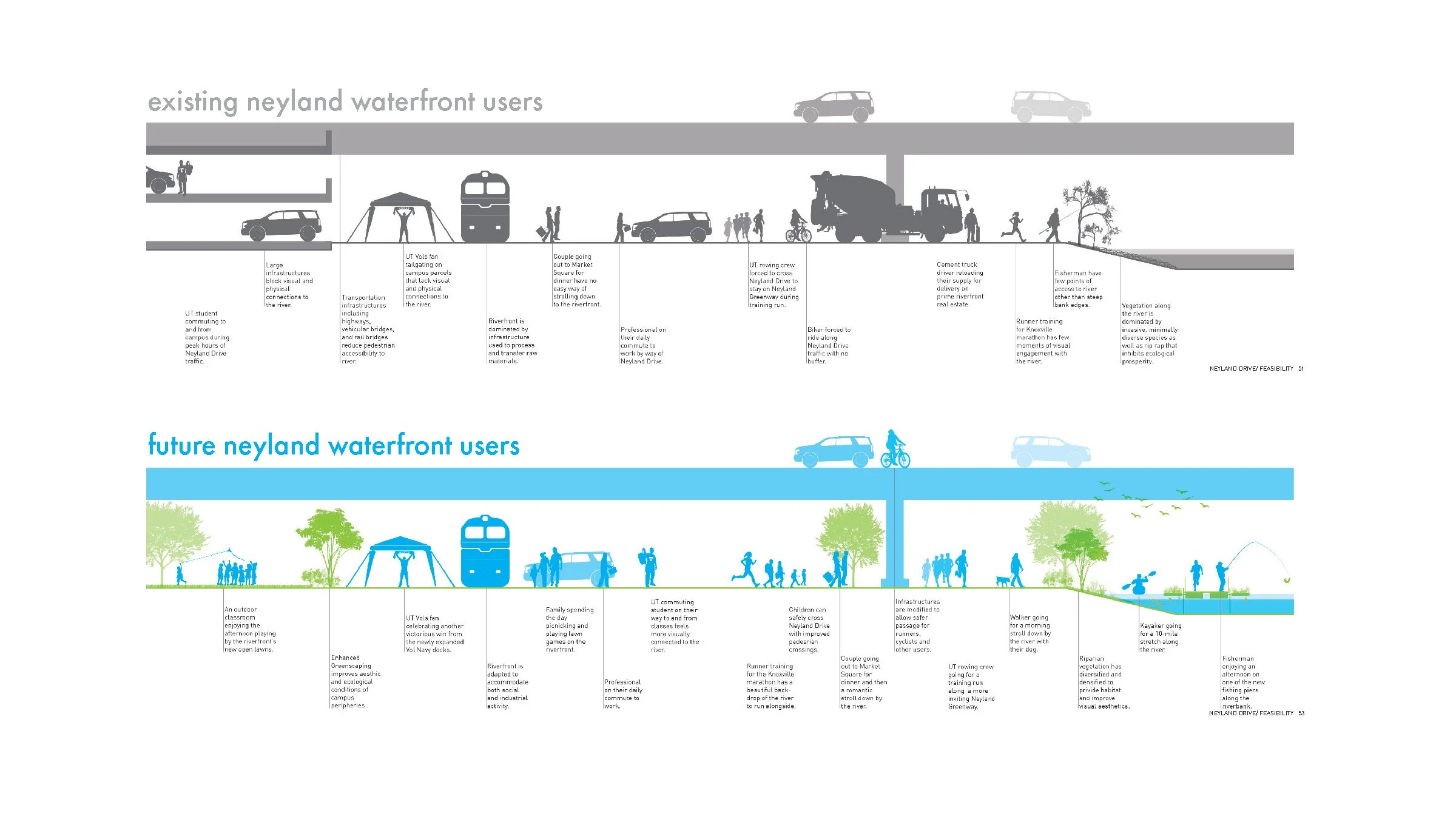
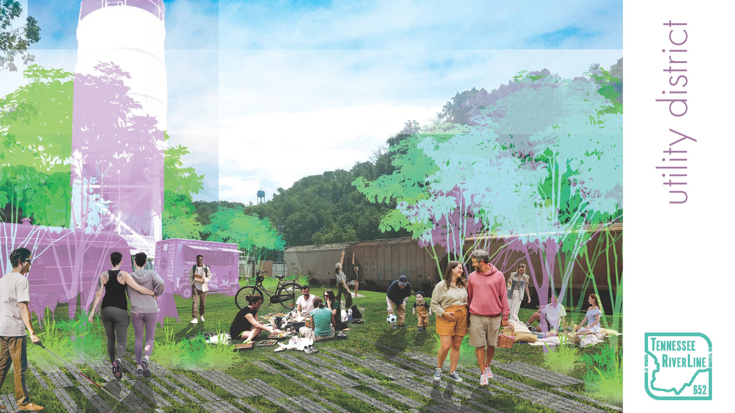
The Neyland corridor of today is a product of necessity, land use decisions, assumptions, and lingering public perceptions of the 20th century when the river was an infrastructure for commerce and waste management and the efficiency of transportation systems precluded the possibility of a public riverfront. A collaboration between the UT School of Landscape Architecture, the UT Department of Civil Engineering, the UT Center for Transportation Innovation, City of Knoxville Engineering, Knoxville TPO, and the Tennessee RiverLine, the Neyland Corridor Study is a speculative reimagination of Knoxville’s north riverfront that prioritizes public space, habitat enhanced infrastructure, and a trajectory for new economic development while maintaining critical infrastructure and transportation access.
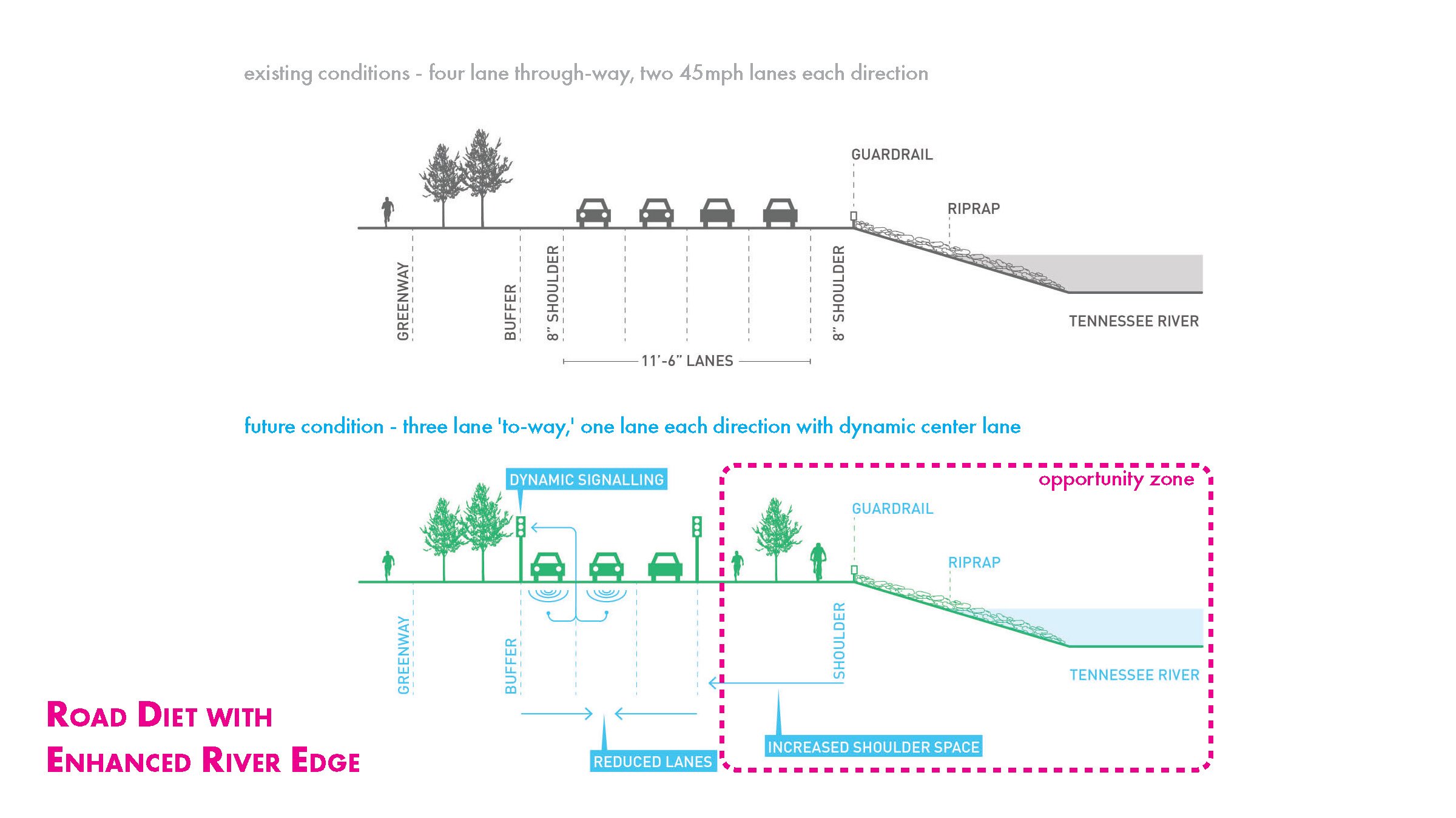
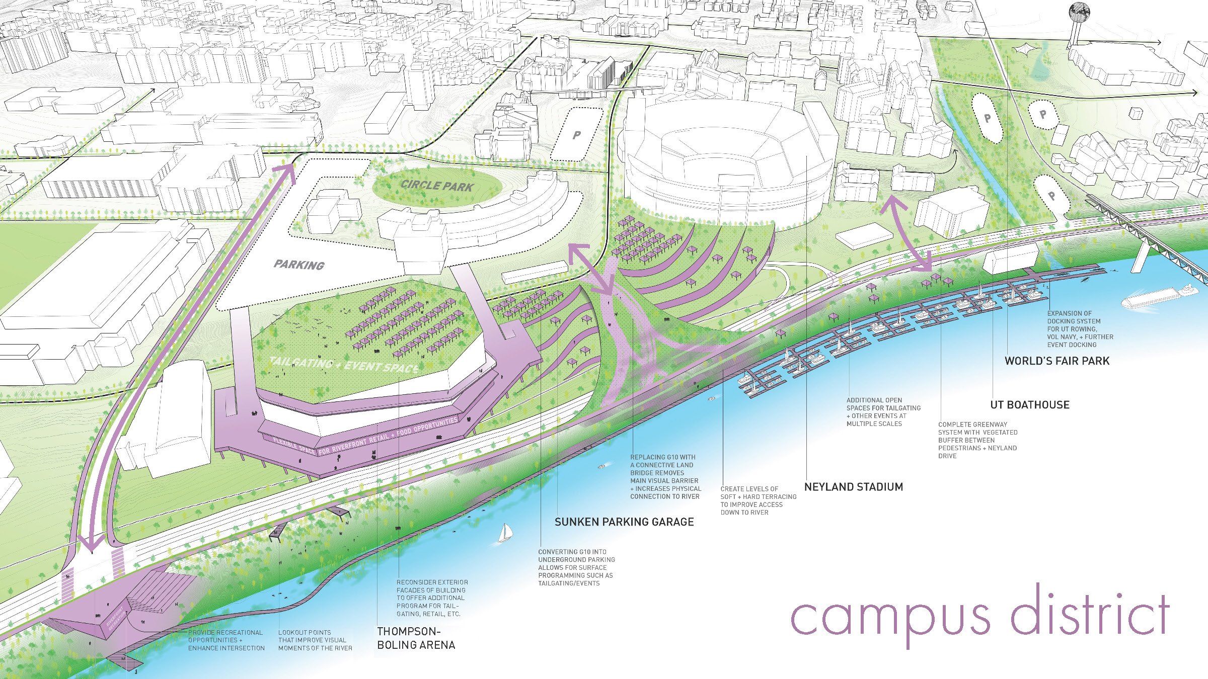
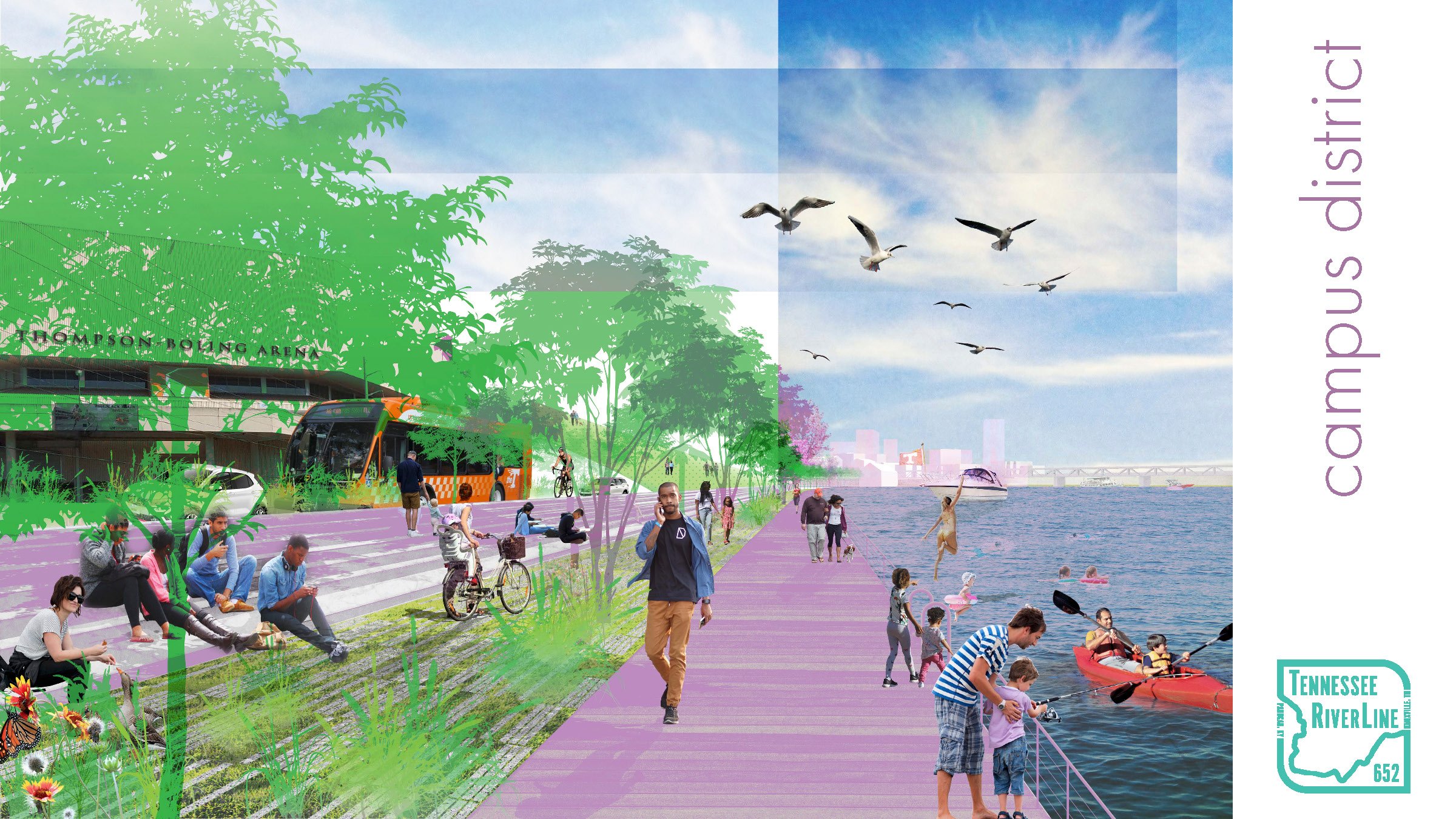
Recalibrating Neyland Drive from a four-lane high-speed thoroughfare as a dynamic three-lane road improves its level of service while allowing the corridor to be transformed as a continuous linear park that optimizes visual and physical access to the river for diverse corridor uses. Distinct Garden, Utility, and Campus districts engage a transformed Neyland Drive a catalyst for new development patterns, integrated streetscapes, and a continuous network of public spaces and river access opportunities that asserts the urban condition of the river as an amenity for area residents and visitors, and an accelerator for economic development in the Knoxville metropolitan area in the same way that riverfront investments have performed in peer communities in the region and around the world.
Location: Knoxville, TN
Project Team: Alexa Macri, Hannah Slyce, Fernando Turpin, Evan Lockhart, Clark Marshall, Collin Williams, Colton Scott, Frank Becker, Dustin Toothman
Faculty Advisors: Brad Collett and Jennifer Rutheford


